

An Afternoon of Exploration – Mining History, Abandoned Farmsteads & After Dark Captures
Feb 22
5 min read
0
10
0
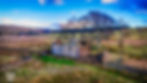
With an afternoon free, I could have stayed at home with nothing to do, but the heritage of the Northeast was calling. The skies were clear, and the wind was just about manageable for flying, so I set off towards Weardale without much of a plan. The journey led me from the remains of mining history along Rookhope Burn to the isolated and forgotten farmsteads of Northumberland, finishing with a late-night capture at Grove Rake Mine.
Wolf Cleugh

Wolf Cleugh is one of many sites along Rookhope Burn that tell the story of the region’s lead mining past. The area was once part of the vast lead mining industry that shaped Weardale, operating during the 18th and 19th centuries. The remains here likely belonged to a processing or storage building, supporting nearby workings by providing a place to crush, wash, and prepare the ore before it was transported.
The landscape surrounding the site is rugged, and the ruined stone structures stand as a reminder of the difficult conditions miners and workers faced. Many of these buildings were abandoned when lead mining declined in the late 19th century, leaving only scattered remnants across the valley.
Capturing this site from above gave a real sense of its position within the landscape. The burn flows nearby, once a vital water source for the mining operations. The stonework is still relatively intact, though nature is slowly reclaiming the structure. The drone shots helped highlight the patterns of the remaining walls, showing how the building once fitted into the industrial workings of the valley. The winter sunlight cast long shadows across the site, adding to the sense of history.
Thorngreen Lime Kilns

Venturing into Northumberland, I visited the Thorngreen Lime Kilns, an impressive set of structures that were once vital to local industry. Lime kilns like these were used to burn limestone, producing quicklime, which had many uses in construction, agriculture, and industry. These kilns were likely active in the 19th century, serving local farms and industries that relied on lime for fertiliser, mortar, and other applications.
The kilns remain in excellent condition, with large stone arches forming a striking feature in the landscape. Unlike some more isolated kilns, these appear to have been part of a more organised and possibly larger-scale operation. The site would have been busy with workers loading limestone from nearby quarries into the kilns before heating it to produce quicklime.
Photographing the kilns from above captured the scale of the operation, with the surrounding landscape providing context to their position. The structure's symmetry and the way it is built into the hillside made for some striking images. The stonework remains well preserved, with the arches still forming an imposing sight. From the ground, the sense of scale was even more impressive, showing how these industrial structures were once a crucial part of rural life.
Blackcleugh Houses

Blackcleugh Houses are two abandoned farm buildings near Allenheads, standing as silent witnesses to the changes in upland farming over the centuries. Farms like these were once home to families who lived off the land, raising livestock and cultivating crops despite the harsh weather conditions. Over time, as farming methods modernised and rural depopulation increased, many of these isolated farmsteads were abandoned, leaving them to decay.
These buildings, constructed from traditional local stone, are showing the weathered signs of age and neglect. They likely date back to the 18th or 19th centuries when farming communities in the North Pennines were more widespread. Their layout suggests they were used both for living quarters and agricultural storage, with barns and animal shelters forming part of the structure.
Aerial photography allowed for a clear view of how these two buildings were positioned within the landscape. The ruins sit exposed to the elements, surrounded by open moorland, reinforcing how tough life must have been for those who lived here. The low winter light created a dramatic effect, enhancing the details of the stonework. Capturing these sites helps to preserve their memory, as they are gradually being reclaimed by the landscape.
West End, Middle Westend & Far West End Farmhouses

These three abandoned farmhouses, all located near Allenheads, follow a similar story to Blackcleugh Houses. They were once active farmsteads, providing shelter and storage for those working the land. Over time, economic pressures and changing agricultural practices made small-scale upland farms less viable, leading many families to move elsewhere.

The stone buildings remain standing, though in various states of disrepair. Some still have partially intact roofs, while others are open to the sky, their walls slowly crumbling. These sites offer a fascinating glimpse into rural history, where generations of farmers battled against the harsh conditions of the North Pennines.

Flying the drone over these locations showed the isolation of each farmstead. They are spaced apart but connected by old trackways, reinforcing the sense of a once-thriving but now abandoned way of life. The aerial perspective also highlighted the surrounding dry stone walls and enclosures, marking out fields that would have been worked centuries ago. The colours of the landscape, with browns and muted greens, contrasted beautifully with the weathered stone, making for some incredible captures.
Grove Rake After Dark

On my way back, I passed Grove Rake Mine, a site I had explored before, but I wanted to capture it again. However, I had spent longer than expected near Allenheads, and by the time I arrived, darkness had fallen. Despite this, I couldn’t resist the opportunity to take some nighttime shots of this historic site.
Grove Rake was one of the last working lead and fluorspar mines in the North Pennines, operating well into the 20th century before closing in the 1990s. The remains of the site include old processing buildings, spoil heaps, and the unmistakable headgear, a rare surviving example of the industrial structures that once dominated the region.
Capturing Grove Rake at night presented a challenge, but also an opportunity for some atmospheric shots. The drone shots gave a unique perspective, revealing the site’s layout even in low light conditions. The dark sky, combined with the stark, angular ruins, created an eerie and powerful effect. This was a completely different way to document the site, and I’ll definitely be returning to refine my nighttime photography further.
Wrapping Up the Day
Today’s trip was a mix of mining history, industrial ruins, and abandoned farmhouses, each telling a story of a time when these landscapes were full of life and activity. From the lead mines of Rookhope Burn to the forgotten farmsteads of Allenheads and the imposing lime kilns of Northumberland, the day offered a glimpse into the past that still lingers in these remote places. Ending with nighttime photography at Grove Rake was an unexpected challenge but one that made for some truly striking captures. Another incredible day exploring the history hidden within the landscape.
Related Posts


